
Goechala Trek Guide 2026: Route, Cost, Permits, Itinerary and Weather
What is Goechala Trek?
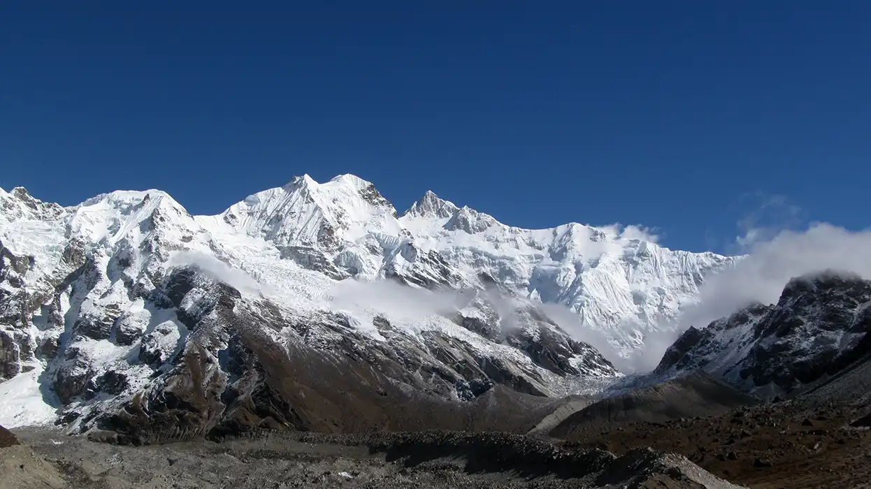
The Goechala Trek is a 10-day high-altitude expedition in West Sikkim that brings you face to face with the southeast wall of Mount Kanchenjunga — the world's third-highest peak.
The route travels approximately 90 kilometres round trip from Yuksom (1,780m) through dense forest, rhododendron belts, alpine meadows, and glacial terrain, reaching Viewpoint 1 at around 4,600 metres (15,100 feet). This guide covers everything you need: route, map, altitude profile, difficulty, day-by-day itinerary, best time, cost, and permits.
Goechala Trek Overview
The Goechala Trek lies entirely within Khangchendzonga National Park, a UNESCO World Heritage Site. It passes through five ecological zones — sub-tropical forest, humid jungle, rhododendron belt, alpine meadow, and glacial moraine — in a single continuous route. The park shelters red pandas, Himalayan tahr, blue sheep, and snow leopards, alongside over 250 bird species.
Since 2017, trekkers are permitted only to Viewpoint 1 (also called Sunrise Point). Access to the actual Goechala Pass saddle at 4,940m is prohibited to protect high-altitude snow leopard habitat. The viewpoint still delivers an unobstructed, close-range look at the Kanchenjunga massif at sunrise, which is the point of the entire journey.
Goechala Trek Route
The Goechala Trek route runs as a straight out-and-back from Yuksom, following the Prek Chu river valley deep into the park before climbing to the high-altitude basin below the viewpoint.
Route sequence (ascending): Yuksom (1,780m) → Sachen (2,300m) → Tshoka (2,963m) → Phedang (3,691m) → Dzongri (3,991m) → Kokchurung (3,686m) → Thangsing (3,936m) → Lamuney (4,138m) → Viewpoint 1 (~4,600m). The descent bypasses Dzongri: Lamuney → Kokchurung → Phedang → Tshoka → Yuksom.
- Yuksom1,780mStart · Forest
- Sachen2,300mDense forest
- Tshoka2,963mRhododendron belt
- Phedang3,691mOpen shoulder
- Dzongri ★3,991mAcclimatisation camp
- Kokchurung3,686mValley descent
- Thangsing3,936mGlacial valley
- Lamuney4,138mHigh camp
- Viewpoint 1 ▲~4,600mPermitted endpoint · Kanchenjunga view
Key landmarks along the Goechala Trek route:
- Sachen — Three suspension bridges cross the Prek Chu here, the first draped in prayer flags. The national park begins at this crossing.
- Tshoka — A small monastery beside a still pond gives the first clear view of Mount Pandim. Rhododendron colour is strongest here in April.
- Phedang (3,691m) — An open shoulder with wide views of the Singalila Range and the Oklathang Valley. Once a campsite; now primarily a rest and lunch stop.
- Dzongri Top (4,167m) — A pre-dawn hike from Dzongri camp rewards with a 180-degree panorama of the Kanchenjunga, Singalila, and Oklathang ranges at sunrise.
- Dzongrila Pass (4,368m) — An acclimatisation excursion from Dzongri camp. Close views of Rathong, Kabru, and the Rathong Glacier.
- Samiti Lake — A glacial lake 2 km from Lamuney camp, reflecting Pandim and surrounding peaks in near-perfect stillness.
- Viewpoint 1 / Sunrise Point (~4,600m) — The permitted endpoint. Kanchenjunga's southeast face fills the skyline directly ahead.
Peaks visible from the upper route include Kanchenjunga (8,586m), Kabru North (7,353m), Kabru South (7,318m), Pandim (6,691m), Rathong (6,679m), Simvo (6,812m), Talung (7,349m), Koktang (6,147m), and Jopuno (5,650m).
Goechala Trek Map
The Goechala Trek map covers the full round-trip trail from Yuksom to Viewpoint 1, running through the interior of Kanchenjunga National Park in West Sikkim. A good Goechala Trek route map should show all major campsites with their altitudes, the Prek Chu river corridor, key ridgelines and passes, and the elevation transitions between zones.
Interactive Route Map — Goechala Trek
Hover (or tap) waypoints to trace the trail from Yuksom through Kanchenjunga National Park.
What to read from the route map:
- The trail rises and falls in a controlled sequence — not a straight climb.
- After Dzongri, it actually drops back into the valley (Kokchurung at 3,686m) before rising again to Lamuney and the viewpoint.
- The steepest single-day gain is between Tshoka and Dzongri — over 1,000 vertical metres in one day.
- Dzongrila Pass and Dzongri Top are short side excursions off the main route, not on the primary path to Viewpoint 1.
- The descent bypasses the steep climb to Dzongri, taking a direct forest trail from Kokchurung to Phedang.
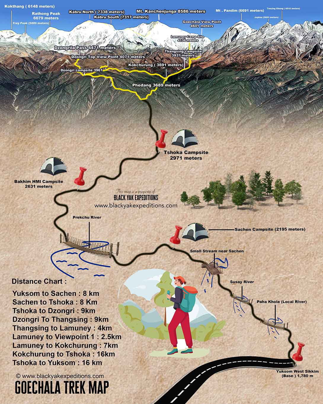
Black Yak Expeditions publishes a detailed, illustrated Goechala Trek route map featuring campsite altitudes, clearly labeled Himalayan peaks including Kanchenjunga (8,586 m), Pandim, Kabru, and Rathong, along with river crossings and a 3D elevation profile. A 4K resolution version of the map is available for download directly from our website.
Note: This map is a proprietary asset of Black Yak Expeditions and is intended for personal use only. Redistribution or uploading to third party platforms is not permitted.
Download 4K MapGoechala Trek Height and Altitude
The maximum Goechala Trek altitude permitted to trekkers is approximately 4,600 metres (15,100 feet) at Viewpoint 1. The actual Goechala Pass — the geographic saddle — sits at 4,940 metres (16,207 feet), but this has been off-limits since 2017.
The Goechala Trek height gain from start to finish is nearly 2,820 vertical metres from Yuksom to Viewpoint 1.
Full Altitude Profile
The most physiologically significant altitude jump is the Tshoka-to-Dzongri segment — a forced gain of over 1,000 vertical metres in a single day. At 4,000 metres, oxygen levels are approximately 40% lower than at sea level. This is the primary reason an acclimatisation day at Dzongri is mandatory and non-negotiable.
Goechala Trek Difficulty
The Goechala Trek difficulty is officially rated moderate to difficult. Specialist grading systems classify it as Level 5, meaning prior high-altitude trekking experience is expected — not preferred.
Three factors drive the difficulty:
Altitude gain rate
The Tshoka-to-Dzongri climb (Day 4) gains over 1,000 vertical metres in a single session. This is the most common trigger for Acute Mountain Sickness (AMS) on the entire route. Symptoms appear when the body climbs faster than it can adapt. The acclimatisation day at Dzongri exists specifically to break this cycle.
AMS symptomsSummit day
Day 8 begins between 1 AM and 3 AM from Lamuney camp. The pre-dawn approach across glacial moraine and the edge of Samiti Lake in sub-zero darkness requires physical endurance and mental focus. The full day — ascent to Viewpoint 1, descent back to Kokchurung — can cover up to 16 kilometres with significant elevation change. This is the hardest single day of the trek.
Key factsDuration and terrain
Ten consecutive days of 6–10 hours of movement at altitude builds cumulative fatigue in a way no single long hike can replicate. The trail surface changes constantly: root-covered forest, stone steps, river crossings, open moraine, and narrow ridge paths all appear within the same journey.
Trail surfaces encounteredWho is this right for: Well-suited for trekkers with prior multi-day mountain experience (Sandakphu, Dzongri, or equivalent), solid cardiovascular fitness, and the ability to carry a daypack for 6–8 hours. Age is secondary to conditioning — but trekkers above 45 must submit a medical fitness certificate before booking.
Who should avoid it: Absolute beginners without mountain experience, anyone with unmanaged asthma, heart conditions, or hypertension, and solo foreign nationals (not permitted under Sikkim regulations).
Minimum training benchmarks: Run 5 km in 35 minutes or less; hike 12 km in a day without significant fatigue; carry a 6–8 kg pack on stairs; train with cardio 4 days a week for at least 4–6 weeks before departure.
Goechala Trek Itinerary
The standard Goechala Trek itinerary spans 10 days from Yuksom to Yuksom, with an essential acclimatisation day built into Day 5. The itinerary below reflects current route norms used by licensed Sikkim operators.
Planning your arrival?
Yuksom is the gateway to the Goechala Trek, and reaching it smoothly is the first step in your adventure. Read this guide to learn the best way to reach Yuksom, including transport options, travel time, and useful planning details.
How to Reach Yuksom-
Day 1
Arrive at Yuksom
1,780m ~150 km drive 6–7 hrsTravel from NJP, Bagdogra, or Pakyong Airport. Check in, complete permit formalities, and rest. Foreign nationals should plan to arrive one day earlier to complete PAP processing in Pelling.
-
Day 2
Yuksom to Sachen
2,300m 8 km 4–5 hrsThe first day on trail is forested and moderately paced. Three suspension bridges cross the Prek Chu river — the first is draped in prayer flags and marks the park entry. Gradients are gentle. Sachen is a small clearing in dense forest.
-
Day 3
Sachen to Tshoka via Bakhim
2,963m 8 km 5–6 hrsGradient increases noticeably. The trail passes the HMI Bakhim camp before the final climb to Tshoka. The monastery beside the reflective pond at Tshoka offers the first clear sightline toward Pandim. In March and April, rhododendron colour is at its strongest here.
-
Day 4
Tshoka to Dzongri via Phedang
3,991m 9.5 km 6–7 hrsThe hardest day of the ascent. Wooden log steps through rhododendron and silver fir give way to open, windswept terrain at Phedang (3,691m), where the Singalila Range comes into full view. The final 3-hour push to Dzongri is demanding. Slow down and do not push the pace.
-
Day 5
Dzongri Acclimatisation Day
3,991m (Sleep) 4,368m (Pass)The pre-dawn hike to Dzongri Top (4,167m) at 4 AM delivers a 180-degree panorama at sunrise. After breakfast, a 4-hour excursion to Dzongrila Pass (4,368m) serves as active acclimatisation with close views of Rathong, Kabru, and the Rathong Glacier. Return to camp by lunch.
-
Day 6
Dzongri to Thangsing via Kokchurung
3,936m 9 km 6 hrsThe trail descends back into the Prek Chu valley through dense rhododendron. Kokchurung (3,686m) offers water and a rest break before the final section to Thangsing, which sits below the towering ice walls of Mount Pandim.
-
Day 7
Thangsing to Lamuney
4,138m 4 km 2–3 hrsDeliberately short to allow the body to adjust before the summit push. Afternoon visit to Samiti Lake (2 km from camp) — its mirror-calm surface reflects Pandim and surrounding peaks. Guide briefs the team on summit day. Sleep early.
-
Day 8
Summit Day
~4,600m (VP1) Up to 16 km 3,686m (Kokchurung)Wake-up between 1 AM and 3 AM. The approach follows the edge of Samiti Lake and crosses glacial moraine in darkness. At sunrise, Kanchenjunga's southeast face is directly ahead at close range. After sunrise, descend to Lamuney, then push on to Kokchurung for the night. Use trekking poles — the descent is punishing on the knees.
-
Day 9
Kokchurung to Tshoka via Phedang
2,963m 16 km 5–6 hrsA long descent back through familiar terrain. Carry a packed lunch. The trail is well-known by this point and the body is moving downhill — pace is faster than the ascent.
-
Day 10
Tshoka to Yuksom
1,780m 16 km 5–6 hrsFinal day. Start by 8 AM — slow trekkers can take the full day. Descend via Bakhim and the Prek Chu forest zone back to Yuksom. Check in at your hotel.
-
Day 11
Yuksom to NJP / Bagdogra
~150 km drive 8–9 hrsDeparture. Leave Yuksom by 8 AM to reach NJP or Bagdogra by late afternoon for evening transit.
Goechala Trek Best Time
The Goechala Trek best time falls within two seasonal windows. Both offer genuinely good trekking conditions — the difference is what you prioritise.
Post-monsoon air is crystal clear. Dry trails, sharp views. Daytime 10°C–15°C at lower camps; -5°C overnight at Dzongri. Best summit-day visibility and photography.
Rhododendron and magnolia bloom at mid-altitude. Prime birdwatching. Clear mornings; clouds build by afternoon. Carry micro-spikes for snowmelt sections.
Heavy rainfall, frequent landslides, cloud-locked peaks, and leeches throughout the lower forest. Operations effectively stop.
Standard operations cease. Temperatures to -15°C. Snow blocks Dzongri–Viewpoint 1. Yak support unavailable. Consider the Dzongri Trek instead.
Goechala Trek Cost
The Goechala Trek cost varies by operator, package tier, and nationality. Black Yak Expeditions offers three structured tiers:
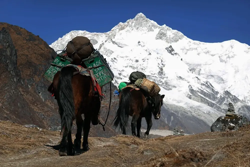
- Budget covers all trekking permits, KNP entry fees, certified guide and cook, group camping gear, meals from Yuksom, and mule/yak carry for group equipment. Does not include Yuksom accommodation or transport from NJP or Bagdogra.
- Standard adds two nights' accommodation in Yuksom (before and after the trek) with meals on Modified American Plan (MAP).
- Premium adds one-way pickup from NJP, Bagdogra, Gangtok, or Pakyong Airport; personal porter (backpack carry included); and a private tent.
Optional add-ons:
- Backpack carried by horse/yak: ₹300/day (₹500 if requested mid-trek)
- Private tent: ₹250/night
Across the broader market, fully supported Goechala Trek packages from other operators start from approximately ₹17,000 for Indian nationals. What separates tiers is group size economics, service depth, and logistical handling.
Group pricing: Packages are based on groups of 10. Smaller groups pay slightly more per person due to fixed costs being split among fewer people. Groups of 15 or more receive a 3% discount.
Payment: 50% advance required at least one month before the trek date; balance due the day before departure. UPI, bank transfer, and PayPal accepted.
Cancellation: 30+ days prior — full refund minus admin fee. 15–29 days prior — 15% refund. Within 14 days or after the trek starts — no refund.
Goechala Trek Permits
Indian Nationals
You do not need a Sikkim Inner Line Permit. Arrive at Yuksom with a valid government-issued photo ID — Voter ID or PAN card is sufficient. Your registered operator handles all three permits:
- KNP (Kanchenjunga National Park) Entry Permit — mandatory, processed at the Yuksom checkpost
- Protected Area Permit (PAP) — required for the Dzongri and Goechala zones; arranged through your operator
- Yuksom Police Registration — completed on Day 0 with your ID and two passport photos
Foreign Nationals
The permit process runs in three steps:
Step 1 — Sikkim Inner Line Permit (ILP)
Obtained before entering Sikkim. Apply online via the Sikkim Tourism portal, or in person at border checkpoints (Rangpo or Melli), at Bagdogra Airport, or at Sikkim Tourism offices in Delhi or Kolkata. This is the foundational document — everything else is built on it.
Step 2 — Protected Area Permit (PAP)
Previously issued only in Gangtok. As of the latest update, PAP is now processed in Pelling for West Sikkim routes, which is more convenient for Goechala trekkers. Once you have your ILP and arrive in Yuksom, your local operator arranges a cab to Pelling for permit processing.
Step 3 — KNP Entry Permit
Processed alongside the PAP, handled by your operator.
- Solo trekking is not permitted — minimum group of two
- Citizens of China, Myanmar, and Bangladesh cannot obtain permits for this restricted border zone
- All permits are non-transferable and non-refundable
- Government-issued photo ID (original + photocopy)
- Three recent passport-sized photographs
- Copies of all applicable permits
- Medical fitness certificate (required for trekkers over 45; recommended for all)
- Indemnity and declaration forms (provided by your operator)
Goechala Trek Tips
- Acclimatise properly, not just technically. The Dzongri rest day is written into every itinerary, but trekkers still push too hard on Day 4. Slow down before you reach Dzongri, not after. AMS symptoms at 3,991m mean your body is already behind.
- Start summit day with everything ready. The 1–3 AM start from Lamuney leaves no time to search for gear in the dark. Pack your daypack the night before, keep your headlamp accessible, and sleep in your base layers so you can leave within minutes of being woken.
- Protect your knees on the descent. The Day 8 return — from Viewpoint 1 down to Kokchurung — covers significant elevation loss under tired legs. Trekking poles are not optional on this day. Learn to descend with a slightly bent knee and short steps; long strides downhill on moraine cause knee joint stress that accumulates fast.
- Manage your water and electronics at high camp. Temperatures at Dzongri and Lamuney drop well below freezing overnight. Hydration bladder tubes freeze solid by morning — use a bottle instead and keep it inside your sleeping bag. Carry a high-capacity power bank; there are no charging points beyond Yuksom.
- Book with a licensed Sikkim operator. Permits cannot be self-processed by foreigners. Indian nationals can technically register independently, but the permit logistics, pack animal coordination, and safety apparatus (emergency oxygen, pulse oximeters, trained trek leaders) are not replicable solo. The operator is not optional infrastructure — it is the infrastructure.
- Compare Goechala and Dzongri before booking. If you are uncertain about your fitness or time, the Dzongri Trek (5–6 days, ending at Dzongri Top at 4,167m) covers much of the same terrain and delivers outstanding Kanchenjunga views without the summit-day demands of Goechala.
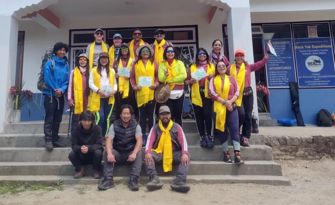
Why do Goechala with Black Yak?
You know the itinerary and altitude. You’ve compared operators. Here’s what matters before you decide.
Most operators selling this trek do not run it. They coordinate from a distance, using subcontractors and rented gear that rotates between groups. You notice this only at 4,000 metres when mismanagement hits you.
We are based in Yuksom. The trek starts here. We do not manage this remotely. We are here in person. The people you meet on day one are all ours. Our guides are trained for this specific trail, not just for high-altitude trekking. Our cook plans meals to meet your nutritional needs at altitude, not just what is easy to carry. Our tents, sleeping bags, and mattresses are expedition-grade and owned by us. They have faced real snow, real rain, and real cold. Nothing borrowed. Nothing cheap.
We are inborn mountaineers, even though we officially started organising the Goechala trail in 2011. Our key difference: we personally manage every smallest detail. When the unexpected happens, it's always our experienced team solving it—never a vendor or a faceless phone number.
If you want straight answers regarding even a small doubt you have, we are ready to talk. If you are searching for the Goechala Trek guide contact number, you have found it. Contact us. We will not oversell. We will tell you the truth, and let you decide.
FAQs
What is Goechala Trek difficulty?
Moderate to difficult, classified as Level 5 by specialist operators. The hardest sections are the Tshoka-to-Dzongri climb (1,000m gain in one day) and the pre-dawn summit push on Day 8. Prior high-altitude multi-day trekking experience is required.
What is Goechala Trek best time?
Mid-October to late November for crystal-clear mountain views. March to mid-May for rhododendron blooms and more moderate temperatures. Both are valid — autumn gives better summit visibility, spring gives richer natural scenery.
What is Goechala Trek cost?
Black Yak Expeditions packages start at ₹32,800 for Indian nationals and ₹42,800 for foreign nationals (Budget tier). Broader market pricing starts from approximately ₹17,000. Cost depends on tier, group size, and inclusions.
What is Goechala Trek height?
Trekkers are permitted to Viewpoint 1 at approximately 4,600 metres (15,100 feet). The actual Goechala Pass is 4,940 metres (16,207 feet) but has been restricted since 2017.
What is Goechala Trek route?
The Goechala Trek route runs from Yuksom → Sachen → Tshoka → Phedang → Dzongri → Kokchurung → Thangsing → Lamuney → Viewpoint 1, and returns by the same path. It is a round-trip of approximately 90 km.
Is Goechala Trek worth it?
Yes, for trekkers who are physically prepared. The sunrise view of Kanchenjunga from Viewpoint 1 — at close range, from open ground — is among the most impressive mountain views accessible on a non-technical trek in India. The 10 days of walking, altitude, and effort are the price of admission.
Can a beginner do the Goechala Trek?
Not without targeted preparation. Trekkers new to altitude should complete at least one multi-day mountain trek above 3,500m first. Physical training for 4–6 weeks before departure is the minimum.
Can I do Goechala Trek solo?
Indian nationals can trek individually through a licensed operator. Foreign nationals cannot — a minimum group of two is required under Sikkim permit regulations.
What is the difference between Goechala and Dzongri Trek?
The Dzongri Trek takes 5–6 days and ends at Dzongri Top (4,167m). Goechala continues for an additional 4 days to Viewpoint 1 (4,600m) for a direct view of Kanchenjunga. Dzongri is the better option for shorter timeframes or first-time high-altitude trekkers in Sikkim.
Is Goechala Trek open in December?
Standard operations do not run in December. The first week of December is occasionally possible with a custom, porter-only setup, but reaching Viewpoint 1 is not guaranteed. For winter trekking in Sikkim, the Dzongri Trek is the more reliable alternative.