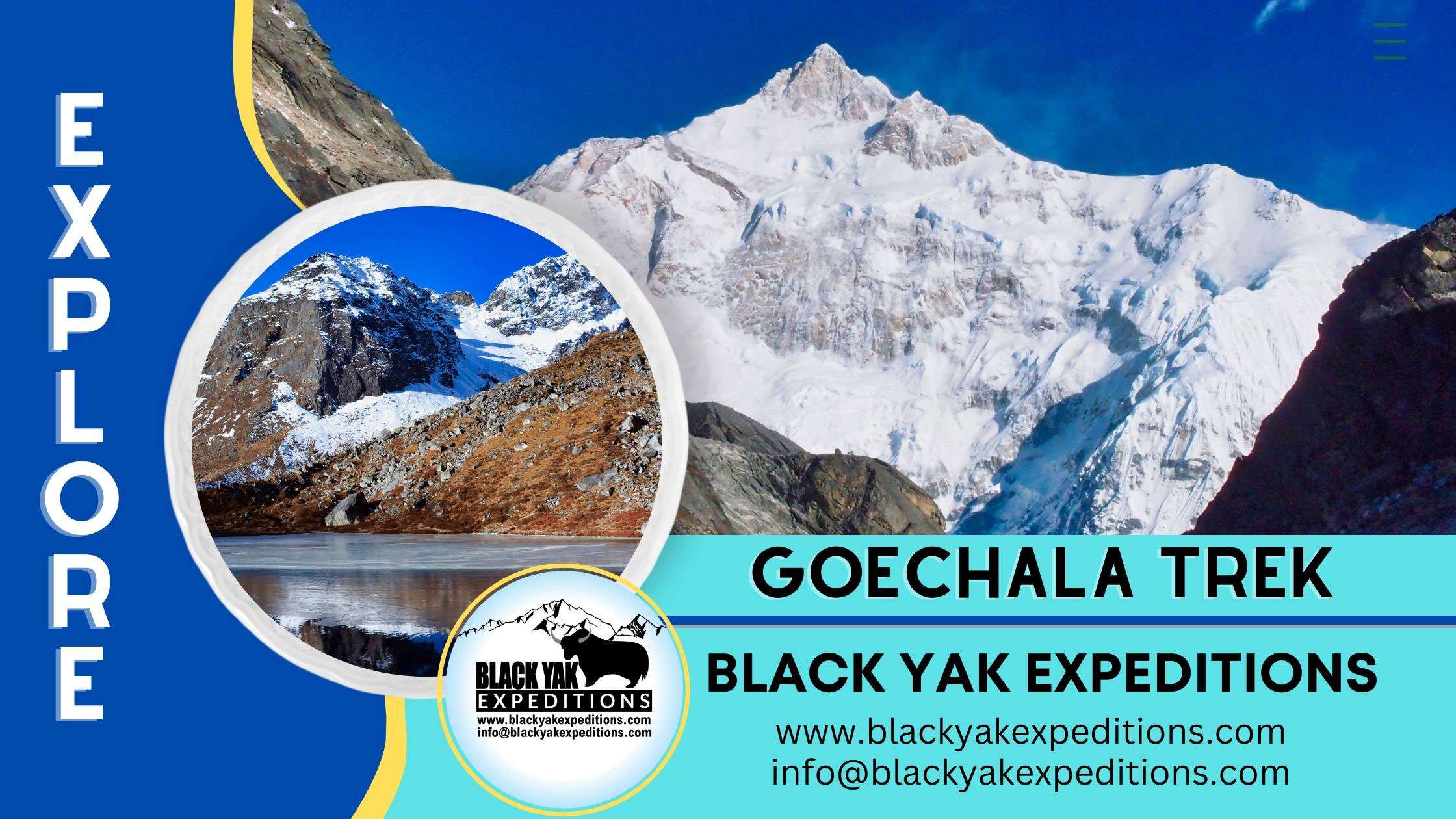
Goechala Trek Guide 2025: Route, Cost, Permits, Itinerary and Weather
The Goechala Trek is one of India’s most iconic high-altitude adventures. It offers a once-in-a-lifetime journey through the Eastern Himalayas, filled with raw beauty, rich culture, and rewarding challenges.
This trek takes you into the heart of Kanchenjunga National Park, a UNESCO World Heritage Site. As you journey, you will see stunning views of Mount Kanchenjunga, which is the third-highest mountain in the world.

Spanning around 90 kilometres, the Goechala Trek Map begins in the peaceful town of Yuksom. From there, it winds through forests blooming with rhododendrons, rivers with crystal-clear water, and quiet alpine meadows. As you climb higher, you will cross suspension bridges, visit hidden monasteries, and camp under the stars beneath Mount Pandim.
The most unforgettable moment comes at sunrise on Dzongri Top and the Goechala Viewpoint, when the first light paints Kanchenjunga’s peaks in glowing gold. If you enjoy photography, the still waters of Samiti Lake reflecting snowy ridges offer rare, perfect shots.
This journey is not just about nature. You will pass through Himalayan villages, meet warm-hearted locals, and experience the simple beauty of Sikkimese life. The region is also home to rare wildlife like red pandas and vibrant Himalayan birds, making it a paradise for nature lovers.
While the shorter Dzongri Trek gives you a glimpse of this beauty, the whole Goechala route is the real expedition. With steep ascents, changing weather, and high altitudes, it demands endurance—but rewards you with scenery and moments you will never forget.
Cultural Heritage and Historical Significance
Local Cultural Significance and Early Explorers
This trek is also a journey through Sikkim’s spiritual and cultural heartland. Kanchenjunga holds deep spiritual and cultural importance for the diverse communities in Sikkim.
Each community—Bhutia, Lepcha, Limboo (Tshongs), and Nepali—has unique stories, beliefs, and reverence associated with the mountain.
For some, Kanchenjunga is seen as a guardian deity that protects the land and its people. For others, it represents the origin of their community or the source of natural and spiritual treasures.
Despite these differences, all share a common respect for the mountain as a sacred and powerful presence in their lives. Festivals such as Pang Lhabsol commemorate the guardian deity of Mount Kanchenjunga.
Kanchenjunga’s Geographical and Ecological Influence on Sikkim
Kanchenjunga plays a climactic role in shaping Sikkim’s climate and ecosystems.
Its towering presence influences weather patterns, creating distinct microclimates that support rich biodiversity.
The Khangchendzonga National Park, a UNESCO World Heritage Site, harbours over 550 bird species and endangered animals, including red pandas and snow leopards.
The mountain’s glaciers, such as the Zemu Glacier, feed Sikkim’s rivers, sustaining wildlife and local communities.
This ecological richness has further deepened the communities’ reverence for Kanchenjunga as a spiritual guardian, linking its natural influence to cultural beliefs.
Early Explorers of the Goechala Region:
Exploration in the area began in the late 19th century, drawing the attention of several notable British explorers, geographers, and scientists. These early expeditions were crucial in mapping and studying the Himalayas and its natural resources.
Douglas Freshfield,
A British mountaineer and geographer, led an expedition in 1899 to complete an entire circuit around the Kanchenjunga massif, becoming one of the first Europeans to extensively map the region. His journey documented previously uncharted territories in Sikkim and Nepal. Freshfield’s detailed accounts and Vittorio Sella’s (an Italian photographer) stunning images were instrumental in popularizing the region among explorers and scientists.
Joseph Dalton Hooker,
A botanist who explored Sikkim in the 1840s was fascinated by the rich plant life of the region. He made valuable contributions to the scientific study of plant life in the Eastern Himalayas. His book, Himalayan Journals, became an authoritative source on the botany of Sikkim.
J.C. White,
The British Political Officer for Sikkim travelled extensively in the area, including his journey to the Zemu Glacier and the Talung Glacier in the early 1890s. White’s collaboration with T. Hoffmann, a photographer, resulted in some of the earliest visual records of the northern face of Kanchenjunga.
W.W. Graham,
A British mountaineer made controversial claims in the 1880s about climbing peaks around Kanchenjunga, including Kabru. Though his accounts were disputed, Graham’s efforts brought attention to the possibility of climbing in the region.
These early explorers were among the first to venture into the Himalayan wilderness. They opened paths through remote and challenging landscapes, setting the stage for others to follow.
Their journeys inspired generations of trekkers and researchers. More than that, their efforts laid the foundation for scientific studies in the region.
Over time, their work helped bring global recognition to Khangchendzonga National Park. Today, the park stands as a UNESCO World Heritage Site—an honor shaped in part by their pioneering legacy.
Goechala Trek Overview
Planning to experience the breathtaking beauty of the Goechala Trek? Here is a quick overview to help you understand what makes this Himalayan journey so unforgettable:
- Trek Route & Map: Begins at Yuksom in West Sikkim and follows a scenic trail through Kanchenjunga National Park, passing key points like Sachen, Tshoka, Dzongri, Thangshing, and Lamuney, ending near Goechala Viewpoint.
- Itinerary Duration: Typically spread across 10 days, including an essential acclimatization stop at Dzongri to help you adjust to changing altitudes.
- Best Time to Trek: Ideal months are mid-October to December for clear mountain views or March to May when rhododendrons bloom across the forests. Avoid during June to September due to heavy monsoon rainfall.
- Trek Distance: The whole route covers approximately 90 kilometres round trip.
- Trek Height: The maximum altitude is around 4,600 meters (15,100 feet) at Goechala Viewpoint 1.
- Trek Difficulty: Rated as moderate to difficult, the trek demands good physical conditioning due to steep climbs, long walking hours, and thin air at higher altitudes.
- Temperature Range: Varies by season. Expect -5°C to 15°C, with much colder nights at high camps, especially from October to December.
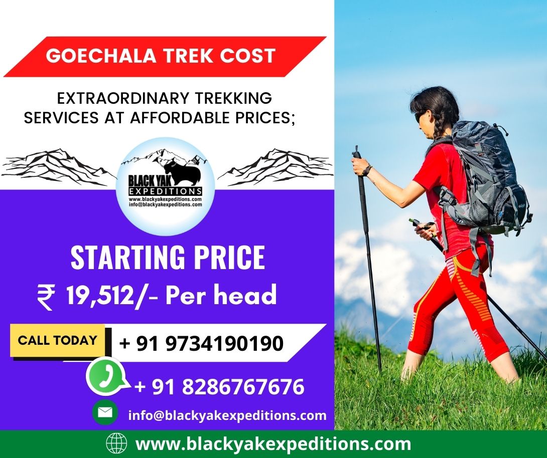
- Trek Cost: Pricing with Black Yak Expedition starts from ₹19,000 per person (Yuksom to Yuksom). Costs may rise based on additional services like vehicles, hotels, or porter upgrades.
- Start & End Point: The trek starts and concludes in Yuksom, a heritage town nestled in the lush hills of West Sikkim.
Goechala Trek Map Overview
The Goechala Trek Map helps you understand exactly what lies ahead on this incredible trail. Created by Black Yak Expeditions, it shows the full route through the wild and beautiful landscapes of West Sikkim.
The trek begins at Yuksom, a quiet mountain town surrounded by forests. From there, the trail moves through deep valleys, wooden bridges, rhododendron forests, and open meadows. As you gain height, you reach camps like Dzongri, Thangsing, and Lamuney, before standing at the Goechala Viewpoint, facing the mighty Mount Kanchenjunga.
This map gives you a clear look at the terrain. It shows where the trail climbs steeply and where it levels out. It also marks important features like rivers, ridgelines, and rest points. If you are planning the trek, this map will help you understand the full journey—from your first step to the final view.
Use it to plan smart, stay prepared, and know what to expect at every stage.
Illustrated Goechala Trek Map 4k resolution
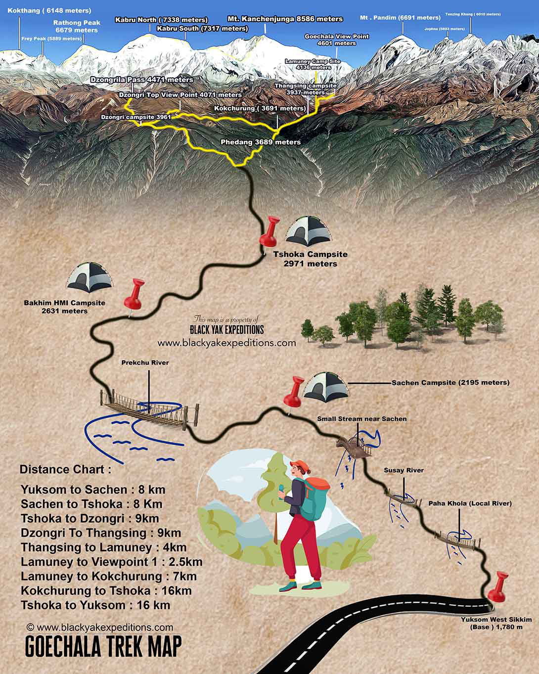
The official Goechala Trek Map by Black Yak Expeditions is a visually immersive representation of the entire trail, enhanced with real altitudes, key visual peaks, and campsite illustrations. This map showcases:
- All major trekking campsites with respective altitudes in meters
- Mountain peaks labeled clearly, including Kanchenjunga (8586 meters), Kabru South, Pandim, and Rathong
- Detailed route paths from Yuksom to Goechala Viewpoint 1
- Realistic visuals of rivers like Prekchu, local streams, and ridgelines
- 3D elevation design to simulate terrain transitions
We have reduced the size of the Goechala trek map on our website to make it load faster. But here’s a link to Google Drive where you can download this map in 4k resolution; Click Here to download
Please note: This map is a proprietary asset of Black Yak Expeditions and is strictly for personal use only. Redistribution or uploading to external platforms is not permitted.
Goechala Trek Map Distance Chart
| Sequence | Destination | Kilometers |
| 1 | Yuksom To Sachen | 8km |
| 2 | Sachen to Tshoka | 8km |
| 3 | Tshoka to Dzongri | 9km |
| 4 | Dzongri to Thangsing | 9km |
| 5 | Thangsing to Lamuney | 4km |
| 6 | Lamuney to Goechala Trek 1st viewpoint | 2.5km |
| 7 | Lamuney to Kokchurung | 7km |
| 8 | Kokchurung to Tshoka | 16km |
| 9 | Tshoka to Yuksom | 16km |
Note: This is a linear distance chart, not a trek itinerary. The full trek itinerary is available in a separate section below.
Best Time to Do the Goechala Trek
If you are wondering about the Goechala Trek best time, it depends on what you want to experience—clear Himalayan views, blooming alpine flora, or snow-lined trails. Choosing the right season is essential, as the weather in the Eastern Himalayas can shift quickly and reshape the entire journey.
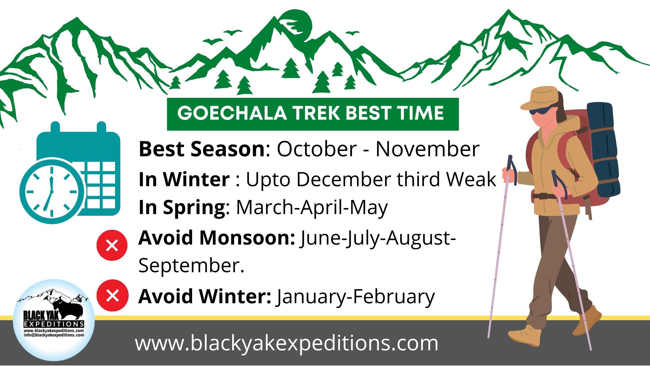
The best time to do the Goechala Trek is generally within two main windows: autumn (mid-October to late November) and spring (March to mid-May). These seasons offer the most stable weather, scenic beauty, and overall trek satisfaction.
Autumn Season (Mid-October to Late November)
Mid-October through November is considered the prime trekking season for Goechala. During this time, the air is cold and dry, and the skies remain exceptionally clear. This is the best time for capturing sweeping views of Mount Kanchenjunga, Pandim, and other high peaks from Dzongri Top and the Goechala Viewpoint.
Temperatures typically range between 5°C and 15°C during the day. At night, especially in higher camps like Thangsing and Lamuney, it can drop to -5°C or lower.
Because the monsoon has just ended, the trails are dry and landslides are rare. Rivers flow steadily, and the mountain light is sharp. For photographers, this is the best time to shoot Samiti Lake, alpine ridgelines, and the sunrise glow on the Kanchenjunga massif.
Goechala Trek in Winter (Late December to February)
The Goechala trekking route becomes extremely difficult during winter, especially from late December through February. The trail is rocky, steep, and narrow in many places. Once snow and ice begin to accumulate, these stretches become too slippery for safe passage. Walking is hard, and even experienced trekkers struggle to find stable footing.
Another issue is logistics. Horses and yaks usually help carry food, tents, and supplies along the trail. But in winter, snowfall covers grazing grounds, and these animals migrate to lower altitudes where they can survive. Without them, human porters must be hired for every load. This increases the cost significantly, especially for longer expeditions.
If you still want to trek in Sikkim during the snow season, the Dzongri Trek is a better option than the full Goechala route. It is shorter and more manageable. Black Yak Expeditions arranges custom winter treks that last around five days. However, keep in mind that these are people-powered. Since no animals can assist, porters must carry all equipment and food, which adds to the overall expense.
Winter temperatures in camps like Dzongri, Lamuney, and Kokchurung can fall as low as -15°C. The freezing conditions make water scarce and movement slow. If you plan your trip for January or February, the chances of reaching Goechala are extremely low. In fact, there is a 95 percent chance your trek will not proceed beyond Dzongri due to snow-blocked trails.
Spring Season (March to Mid-May)
Spring is the next best time to do the Goechala Trek. It is especially appealing for nature lovers. From March through early May, the forests between Yuksom and Dzongri explode in color, with rhododendrons, magnolias, and other wildflowers blooming in layers across the slopes.
This season offers a more vibrant atmosphere. While snow may still linger in higher zones like Thangsing and Lamuney, it only adds contrast to the greenery below. Clear skies are common in the mornings, although you may see brief rain or fog later in the day by mid-spring.
If you are interested in birdwatching, spring is ideal. The national park is more active with calls and colors from species like the Himalayan monal, blood pheasant, and satyr tragopan.
When to avoid Goechala Trek?
The monsoon months—June, July, August, and September—bring heavy rainfall to Sikkim. The Goechala trekking route becomes muddy, unstable, and often dangerous. Cloud cover blocks views, small streams overflow, and landslides are frequent.
Winter (especially January and February) is equally difficult. Snow accumulates rapidly, blocking sections of trail between Dzongri and Goechala Viewpoint. Many water sources freeze, and yak or horse support becomes unavailable as they descend to warmer altitudes.
Although a few treks are still possible during the first half of December, the window is narrow and requires strong preparation. After the third week of December, trekking is not advisable unless you are equipped for sub-zero temperatures and are supported by local staff experienced in winter logistics.
Goechala Trek Cost and Package Options
Planning your trek to Goechala involves understanding the different budget ranges. At Black Yak Expedition, we provide three distinct pricing tiers to suit the needs of solo travelers, small groups, and large expedition teams. The Goechala Trek cost depends on many factors such as group size, porter/yak availability, and seasonal challenges.
These packages include all standard inclusions required for a complete Himalayan trek—from permits to meals and professional support. You also have the flexibility to choose add-ons based on comfort, weight load, or transportation needs.
Budget Goechala Trek Cost – ₹19,512 per person
This is the most affordable option for those who want to complete the Dzongri Goechala Trek with essential logistics covered.
Cost:
- ₹.32, 800/- for Indian nationals
- ₹.42, 800/- for foreign nationals
Includes:
- All trekking permits and Kanchenjunga National Park entry fees
- Official campsite charges
- Certified guide, cook, kitchen helpers
- Group camping gear: tents, mattresses, sleeping bags
- All meals during the trek (starting from Yuksom)
- Mules or yaks for carrying group equipment
Excludes:
- Accommodation in Yuksom
- One-way pickup from NJP/Bagdogra/Pakyong
- Personal porter or private tents (optional add-ons)
Optional Add-ons:
- Backpack on horse/yak: ₹300 per day (₹500 if requested mid-trek)
- Private tent: ₹250 per night
This package is ideal for trekkers who already have travel experince experience and are looking for a cost-effective Goechala Trek price without compromising safety.
Standard Goechala Trek Package – ₹28,740 per person
A balanced option that offers accommodation and meals in Yuksom before and after the trek, along with all essentials during the trail.
Cost:
- ₹.49, 900/- for Indian nationals
- ₹.59, 900/- for foreign nationals
Includes everything from the Budget Package, plus:
- Two nights’ stay in Yuksom (before and after the trek)
- Meals at Yuksom under Modified American Plan (MAP)
Excludes:
- Pickup/drop transport (optional)
- Porter for personal load (available at extra charge)
The Standard Goechala Trek package is best suited for those who want a well-rounded experience without the hassle of arranging separate stays and meals at the base.
Premium Goechala Trek Price – ₹44,024 per person
This is the highest-tier service for those seeking complete comfort, convenience, and logistics taken care of from arrival to departure.
Cost:
- ₹.84, 500/- for Indian nationals
- ₹.94, 500/- for foreign nationals
Includes everything from the Standard Package, plus:
- One-way pickup from NJP, Bagdogra Airport, Gangtok, or Pakyong Airport
- No charges for backpack porting (included)
- Private tent for solo privacy or comfort
If you want a premium Goechala Trek package with complete local coordination and no logistical stress, this is the ideal plan.
Additional Charges for Foreign Nationals
All non-Indian nationals must add ₹5,000 to their package. This covers the higher permit fees, park entry charges, and documentation required by the state government. Black Yak Expedition handles this paperwork for you.
Group Size, Discounts, and Payment Policy
At Black Yak Expedition, the cost of each Goechala Trek package is calculated based on a group size of 10 participants. This size allows for efficient logistics, shared resources, and optimal support staff ratios.
If your group is smaller than 10 people, the cost per person will be slightly higher. This is because fixed expenses like guide fees, camping equipment, permits, and cook support remain the same but get divided among fewer trekkers.
However, we offer a 3% group discount if you book as a team of 15 or more trekkers. This applies to school groups, trekking clubs, or corporate outings. It is our way of supporting group expeditions and encouraging community travel.
Advance Payment and Balance Settlement
To secure your spot, a 50% advance payment is required at least one month before the trek date. This advance helps us arrange permits, staff, gear, accommodation, and resource allocation for your group well in advance—especially during peak seasons like spring and autumn.
The remaining 50% balance must be paid the day before the trek begins, either online or in person at our Yuksom base office.
We accept:
-
UPI (Google Pay, PhonePe, BHIM)
-
Online bank transfers (within India)
-
PayPal (for international payments)
Once your booking is confirmed, our team will provide detailed instructions, receipts, and real-time support.
Cancellation and Refund Policy
We understand that travel plans can change unexpectedly. Our refund structure ensures a balance between flexibility for clients and sustainability for local staff and vendors.
-
Cancellation 30 or more days in advance: Full refund minus a small administrative fee (for processing and bank charges)
-
Cancellation between 15 and 29 days: Eligible for a 15% refund
-
Cancellation within 14 days or after the trek starts: No refund possible, as all logistics would already be engaged
Once a trek begins, the full amount is considered non-refundable due to fixed costs and staff mobilization.
Permits and Documents Required for Goechala Trek (2025 Update)
The Goechala Trek passes through the Kanchenjunga National Park in West Sikkim, one of India’s most ecologically sensitive regions. As such, both Indian and foreign nationals are required to obtain multiple permits, all of which must be processed through registered trekking operators like Black Yak Expedition.
Since 2017, trekkers are only allowed up to Goechala Viewpoint 1 4602 meters, known as Sunrise Point. Access beyond this point is prohibited to protect snow leopard habitats.
Permits Required for Indian Nationals
1. Kanchenjunga National Park Entry Permit
Issued by the Forest Department either in Gangtok or at the entry checkpoint in Yuksom, this permit is mandatory for entering the national park. It must be presented at every forest checkpost en route.
2. Protected Area Permit (PAP)
Though commonly associated with foreigners, a PAP is also required for Indians trekking in protected zones like Dzongri and Goechala. It is issued by the Tourist Information Centers in Pelling or Gangtok after clearances from the Home, Forest, and Army departments. This permit must be processed via a registered travel agency such as Black Yak Expedition.
3. Yuksom Police Registration
Before starting the trek, all Indian trekkers must register with the local police at Yuksom. Required: original and photocopy of a government-issued ID, two passport-sized photographs, and trek itinerary.
Permits Required for Foreign Nationals
Foreigners must complete a three-step permit process with several restrictions and formalities:
1. Inner Line Permit (ILP) or Restricted Area Permit (RAP)
All foreign nationals must obtain this entry-level permit to enter Sikkim.
Where to Obtain ILP:
-
Border Checkpoints: Rangpo and Melli (8 AM to 8 PM)
-
Bagdogra and Pakyong Airports (at Sikkim Tourism counters)
-
Sikkim Tourism Offices in Siliguri, Kolkata, and New Delhi
-
Online via the Sikkim Tourism portal (limited availability)
Documents Required:
-
Original passport and a copy
-
Valid Indian visa with entry stamp
-
Two passport-sized photographs
Citizens of China, Myanmar, Pakistan, and Bangladesh require prior approval from India’s Ministry of Home Affairs.
2. Protected Area Permit (PAP)
This is the main trekking permit for foreigners entering Goechala and Dzongri inside Kanchenjunga National Park.
Key Rules:
-
PAP is only issued to groups of two or more foreigners
-
It cannot be processed in advance—only after a valid ILP is obtained
-
Trekkers must arrive in Yuksom at least one day early (Day 0) for in-person processing
-
Must be arranged through authorized operators like Black Yak Expedition
Documents Needed:
-
Scanned passport and visa
-
ILP copy
-
Passport-sized photographs
-
Detailed trek itinerary
Processing Time & Cost:
-
Requires one full working day in Yuksom
-
Approximate cost: ₹4,000–₹5,000 per person + 5% government tax
3. Sikkim Police Registration
All foreign trekkers must register within 24 hours of entering Sikkim. This is handled at the Yuksom Police Checkpost with the help of your trekking agency.
Essential Document Checklist for All Trekkers
Every trekker, Indian or foreign, must carry the following:
- Two government-issued photo IDs (original + photocopy)
- Three recent passport-sized photographs
- Printed and digital copies of KNP Entry Permit, ILP, PAP as applicable
- Medical fitness certificate (recommended)
- COVID-19 vaccination certificate (if required)
- Indemnity and declaration forms (provided by Black Yak Expedition)
Important:
- Permits are non-transferable and non-refundable
- Solo foreign trekkers are not permitted for this route
- All foreign nationals must be in Yuksom one day early for PAP formalities
Goechala Trek Difficulty and Physical Fitness Requirements
The Goechala Trek is a high-altitude trail that demands preparation. It climbs from 1,780 meters at Yuksom to 4,650 meters at Goechala Viewpoint 1, with sharp elevation gains, remote terrain, and cold conditions.
Though you will not need ropes or mountaineering tools, the trail tests your stamina, breathing control, and ability to adapt to thinning air.
At Black Yak Expedition, we classify the Goechala Trek difficulty as moderate to challenging. It is suitable for well-prepared beginners and intermediate trekkers—but not for casual walkers or comfort-seekers.
How Altitude Affects Your Body
The trek reaches altitudes where oxygen levels drop sharply. At 4,000 meters, oxygen is nearly 40 percent lower than sea level. You may experience:
- Shortness of breath on mild slopes
- Headaches, fatigue, or trouble sleeping
- Loss of appetite or nausea
These are early signs of Acute Mountain Sickness (AMS). Without proper rest and hydration, symptoms can worsen quickly. That is why we include an acclimatization day at Dzongri in every itinerary, and our team constantly monitors your condition during the trek.
Trail Conditions That Make It Demanding
The full Goechala route covers 90 kilometers over 8 to 10 days. Trails vary sharply:
- Forest zones near Tshoka can be muddy and root-covered
- Rocky stair-like climbs begin after Phedang
- The final push from Lamuney to Goechala Viewpoint begins before sunrise in sub-zero wind chill
River crossings, changing weather, and long walking hours (up to 10 hours on summit day) all contribute to the Goechala Trek difficulty. You must carry your own backpack unless you opt for porter support.
Seasonal Challenges That Increase Risk
Weather changes fast in the Eastern Himalayas. Even summer treks can face snowfall near Goechala. Here is what to expect in each season:
- Spring (March–May): Rhododendrons bloom, but snowmelt can make trails slippery
- Autumn (October–November): Clear skies, cold nights, and wind exposure
- Winter (December–February): Deep snow, closed trails, and no yak support
During winter, Black Yak Expedition does not operate full Goechala treks. However, we do offer custom Dzongri treks in early December for experienced hikers.
Who Should Not Attempt This Trek
Even though Goechala is non-technical, it is not for everyone. Avoid this trek if:
- You have not trained with cardio or endurance work
- You have asthma, heart conditions, or blood pressure issues
- You rely heavily on mobile connectivity or need luxury facilities
- You are a solo foreign traveler (not allowed past Dzongri under Sikkim rules)
- You cannot handle 4 to 6 hours of walking daily, for several days in a row
Black Yak Expedition will never approve a booking if we believe it risks your safety.
How to Train for Goechala
You do not need to be an athlete, but you must prepare your body for high-altitude hiking.
Minimum fitness benchmarks:
- Jog 5 kilometers in 35 minutes or less
- Walk or hike 12 kilometers in a day without exhaustion
- Practice carrying a 6–8 kg backpack during stair climbs
- Include cardio sessions at least 4 days a week for 1 month
Trekkers above 45 years or with prior health concerns must submit a fitness certificate before departure.
Goechala Trek Itinerary in keypoints
So far, we have covered the following topics;
- Goechala Trek Map.
- Goechala Trek Cost.
- Goechala Trek Best Time.
We are going to discuss the Goechala Trek Itinerary in this section. A brief itinerary with essential points has been provided first. After this, you will find a detailed Goechala trek itinerary below.
Day 1: Reach Yuksom
- Reach Yuksom from preferred destinations like New Jalpaiguri Railway Station (NJP)/Bagdogra Airport/Pakyong Airport.
- Total distance: 150 km.
- Estimated Time: 6 to 7 hours. Check-in at Hotel or homestay in Yuksom.
Day 2: Yuksom To Sachen
- Start on foot from Yuksom to Sachen.
- Distance: 8 km.
- Estimated Time: 4 to 5 hrs.
- Altitude Gain: 2300 meters.
Day 3: Sachen to Tshoka
- Distance: 8 km.
- Breakpoint: Bakhim
- Estimated Time: 5 to 6 hours.
- Altitude Gain: 2963 meters.
Day 4: Tshoka to Dzongri
- Distance: 9.5 km.
- Breakpoint: Phedang
- Estimated Time: 6 to 7 hours.
- Altitude Gain: 3959 meters.
Day 5: Dzongri Acclimatization
Go to Dzongri top in the morning and Dzongrila Pass during the day.
Day 6: Dzongri to Thangsing
- Distance: 9 km.
- Breakpoint: Kokchurung.
- Estimated Time: 6 hours.
- Altitude Gain: 3936 meters
Day 7: Thangsing to Lamuney
- Distance: 4 km.
- Estimated Time: 2 to 3 hours.
- Elevation Gain: 4138 meters.
Day 8: Lamuney to Goechala Viewpoint 1 and ascend down to Kokchurung
- Distance: 3.4 km.
- Estimated Time: 2.5 hrs.
- Elevation Gain: 4603 meters.
Ascend down to Kokchurung after coming down to Lamuney Camp from Goechala trek viewpoint 1.
- Lamuney to Kokchurung Distance: 6.5km.
- Altitude Drop: 3686 meters.
- Estimated Time: 2 to 3 hours.
Day 9: Kokchurung to Tshoka via Phedang
- Distance: 16 km.
- Estimated Time: 5 to 6 hours.
Day 10: Tshoka to Yuksom
- Distance: 16 km.
- Estimated time: 5 to 6hrs.
- Altitude drop: 1743 meters.
Goechala Trek Itinerary in Details
You can read more about the Goechala Trek Itinerary in this section.
Goechala Trek Itinerary Day 1: Reach Yuksom
On the first day of the Goechala trek, you must get to Yuksom. If you have booked a pickup service with us, a coordinator from Black Yak Expeditions will pick you up wherever you are. The place can be New Jalpaiguri Railway Station (NJP), Bagdogra Airport in West Bengal, or Pakyong Airport in East Sikkim.
The reserved car should get you to Yuksom after 5 to 6 hours on the road. In Yuksom, you will check into a hotel or a homestay.
Day 2: Yuksom to Sachen
The route map for the Goechala trek starts on foot from Yuksom on the second day. You will slowly move away from the small town of Yuksom and into the wilds of Kanchenjunga National Park.
You will walk past beautiful rivers that roar and streams that gurgle on your way to Sachen, where you will camp. Today, hills covered in a lush green forest will attract your attention.
The walk from Yuksom to Sachen is about 8 kilometers long and should take four to five hours. In the past, tourists were taken straight to Tshoka on the first day.
Trekkers found out that it was not only challenging but that it also made them more likely to get High Altitude Sickness. Stopping at Sachen will help your body get used to the altitude.
Tips: When going on the Goechala trek route, you should always start climbing slowly from Yuksom. Most trekkers rush on the first day because they are excited and want to see everything. Always remember that you need to save energy for the rest of the climb. Above all, you also need the power to go down the same route to Yuksom.
Day 3: Sachen to Tsokha via Bakhim
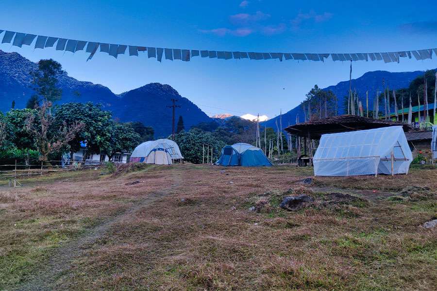
From Sachen to Tshoka, the walk is going to be a little different. Your guide will lead you to the Tshoka campsite after breakfast. The second day of the Goechala Trek ends at the Tshoka campsite.
You will walk amidst green woods as you take your steps toward Tshoka. After 45 minutes of walking from the Sachen campsite, you will reach a long suspension bridge. People in the area call the river Prekchu. Here, the force of the fast-moving river creates a cool breeze that you can enjoy.
You will come across a campsite called Bakhim before you get to Tshoka. The Himalayan Mountaineering Institute sets up camp at Bakhim (HMI). At Bakhim, there is a small local stall where you can enjoy tea.
After getting some refreshments, you can start hiking to Tshoka. From Bakhim, it should take you about an hour and a half to get to Tshoka.
The whole distance from Sachen to Tshoka is 8 kilometers. Tshoka has a range of 2963 meters in height. In Tshoka, the scene changes a lot more than it does in Sachen Campsite. The rhododendron bushes are full of flowers in March and April.
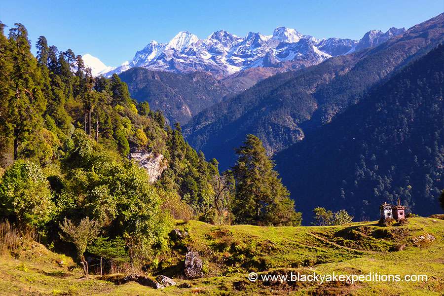
If the sky is clear, you can see the mountain scenery in a great way. From Tshoka, you can see that the top of Mt. Pandim looks like a beautiful dome. You will also see Tenzing Khang and Jophnu.
Goechala Trek Day 4: Tsokha to Dzongri via Phedang
Tshoka to Dzongri is going to be a challenging climb. Most of the way will go up. After going up a short distance from Tshoka, you will come to a path made of wooden planks. You will climb up a lot today. As you go up, you’ll see that the environment changes. Short Rhododendron and magnolia bushes will replace tall trees. You’ll see tall silver fir trees scattered in pretty bad shape until you reach Phedang.
The total distance from Tshoka to Dzongri is around 10 kilometers. Most trekkers should be able to reach Dzongri within 5 to 6 hours. On the way, you will stop at a place called Phedang. Before continuing to Dzongri. The distance from Tshoka to Phedang is 5 kilometers. Phedang is about 3691 meters above sea level. Your staff will plan whether you get a hot or packed lunch.
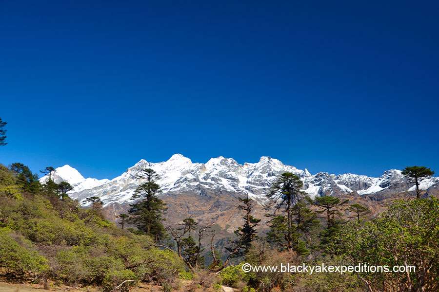
During the clear weather, Phedang offers a scenic view of the Himalayas. You will see Oklathang Valley. The mountains you see from this place are Mt. Pandim, Tenzing Khang, and Jophnu. On the left, you will also see the partial part of the Singalila Range.
Once Phedang used to be an isolated campsite. Trekkers camp here only in case of an emergency. The main problem in Phedang is that there is no water source nearby. Some people from the area are looking after the campsite today. For a small fee, they will fill up your water bottles.
Some people get sick from the high altitude while climbing up and decide to stay at Phedang. If you start to feel sick, have a headache, feel dizzy, or tired, it’s best not to go to Dzongri. Once more, you have to push yourself harder to get to Dzongri. It should take three hours to reach Dzongri from Phedang.
Goechala Trek Itinerary Day 5: Resting day in Dzongri
The day spent getting used to the altitude at Dzongri is the second most memorable part of the Goechala Trek. Early in the morning, your guide will take you to the Dzongri Top viewpoint to see the beautiful sunrise.
Local people call the Dzongri top Daphla Gang, which comes from the Tibetan language. It is a place where people offer prayer to Mount Kanchenjunga.
The top is about 4167 meters high. Almost 200 meters extra than where you camp. The campsite at Dzongri is just under 4000 to 3991 meters above sea level.
During the winter, the temperature can get very low at Dzongri. It can be below minus degrees at night and early in the morning. To get to Dzongri Top, you must be brave enough to get up around 4 AM.
When your trek guide wakes you up, you might have to start right away. So, sleeping in warm clothes inside the tent would be best. That way, you can begin immediately in the morning without wasting time getting dressed.
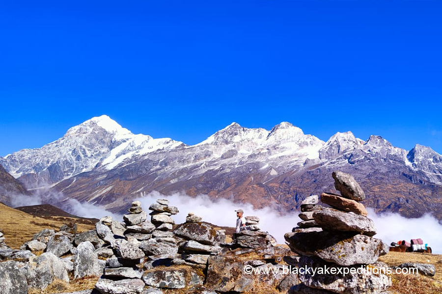
Apart from the sunrise, the landscape is heavenly from the top. If you look down towards Yuksom, You will witness clouds lingering below you. The meadows of Dzongri look mesmerizing. You will also see a 180-degree view of the Himalayas, including Mt. Kanchenjunga. The view starts from the Singalila Range on the left and ends at the Oklathang range on the right. Singalila range acts as the border between Nepal and Sikkim.
From the Dzongri top, you can see Kokthang, Frey Peak, Rathong Peak, Kabru North, South, Kabru Dome, Fork Peak, Mt. Kanchenjunga, Mt. Pandim, Jophnu, Tenzing Khang, and Narsing.
Your staff will serve you the morning breakfast after coming down from the top.
Excursion to Dzongrilla Pass
After breakfast, once again, prepare for approx 4 hrs hike to Dzongrilla Pass. Dzongrilla Pass is on the route to Basecamp. Dzongrilla Pass is 4368 meters above sea level, almost the same height as the Goechala viewpoint. So, it would help if you hiked to Dzongrilla Pass to prepare your body for Goechala Trek.
Dzongri is like a junction in the Goechala trek route. From the Dzongri camp, there are many ways to hike to different places. One diversion from the campsite takes trekkers to a center known as Basecamp.
Basecamp belongs to the Himalayan Mountaineering Institute (HMI), one of the best mountaineering institutions in the world. You can find the headquarter of HMI in Darjeeling. Every year HMI conducts climbing courses at Rathong Glacier.
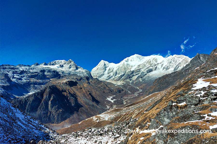
During your trip from Dzongri to Dzongrilla Pass, you won’t make it to Basecamp. But if the weather is clear, you will get a close-up view of some peaks that will leave you speechless. You can see Kokthang, Frey Peak, Rathong Peak, Rathong Glacier, Kabru North, Kabru South, and Black Kabru from Dzongrilla Pass.
A maximum of Four hours should be enough to go and return to the camp from the pass. You can start with a small backpack containing water and light snacks. You will be back in Dzongri by Lunch Time.
Is It important to take one day break at Dzongri?
Yes, it’s a good idea to spend a day at Dzongri before continuing with the Goechala trek map. As we have stated earlier, Dzongri is a central point on the route. If you get sick, a rescue operation will be able to reach you faster from Yuksom.
But things will become more challenging if you get sick on the way to Thangsing after leaving Dzongri. The rescue team will have a harder time getting to you. If your health worsens on the way after Dzongri, then it can be life-threatening.
Halting at Dzongri will give your body time to adapt to the higher altitude. If you don’t feel well, don’t attempt further to Goechala. It’s indeed wise to go back to Yuksom from Dzongri. From Dzongri, there will always be someone who can safely assist you to Yuksom.
Day 6: Dzongri to Thansing via Kokcharang
From Dzongri, trekkers will move on an 8-km journey to Thansing after crossing the Kokcharang. The forest areas at the initial trail are filled with dense rhododendron plantations. Then trekkers descent to Kokcharang, where hikers can enjoy a drink. Trekkers can also refill water for the remaining trek route. You can make use of the huts available at Kokcharang. Without wasting much time, start walking down the bridge of the Prekchu river. Next trek for 2 kms to Thansing. Since the trail is smooth at the beginning and becomes rough while you proceed, trekkers need to be careful while trekking. The temperature is relatively high, so proper clothes should be worn.
Day 7: Thansing to Lamuney
On this day, the morning trek starts from 8 am with breakfast at 9 am, and the Goechala trek fixed departure at 10 am. The seventh day is the most fun-loving day. The road to Lamuney is relatively smooth. However, trekkers face a little bit of difficulty climbing the steep rocky areas as they move forward. In Lamuney, trekkers can enjoy their lunch and take little rest. 2 kms from Lamuney lie the Samiti Lake that trekkers will prefer exploring. Distance from Lamuney to Samiti Lake can be easily covered in an hour. The tour guide will provide briefs of the next day at the campsite as it will be a hectic one. In the night, enjoy the chilling weather along with the clear night sky. Have a good sleep as the next day should be begun quite early.
Day 8: Lamuney to Goechala via Samiti Lake back to Lamuney
The eighth day is the longest and the most challenging day of the lot, where the trekkers have to go to Goechala and return to Lamuney. The distance to be covered in 13 hours. The next day, trekkers will be called at 1 am. morning. Since trekkers need to ascend and descend a long journey, it is wiser to start early. Also, the earlier trekkers leave for Goechala, the better view they will get of the sunrise in the Himalayan range. Some of the peaks that trekkers can spot here are Kabru North, Kabru South, Kabru Dome, Sinvo, Gocha Jupano, Pandim, Kanchendzonga, and Tenzinkhay. After an entire tiresome day, reach the campsite at Lamuney and cherish a hot lunch. Keep your belongings packed and get prepared for the next campsite at Thansing or Kokcharang.
Day 9: Thansing or Kokcharang to Tsokha via Phedang
The next day is a 7-hour trek to cover 16 kms to reach Phedang. The day starts at 7 am so that you can reach the destination by 3 – 4 pm. Carry packed lunch to avoid stopping in between. In the first trail, trekkers have to cross Dzongri without having to travel through too much of a diverse road. Since the path does not consist of any steep ways, the environment here is quite fascinating. The most magnificent in this trail is the snow-covered peak of Mount Pandim. The cool breeze of the mountains is very relaxing and refreshing. After taking the desired rest, trekkers will continue trekking till Tsokha, about 5 kms from Phedang. Avoid too many breaks as trekkers will have to reach Tsokha before it is dark. Have a good night’s sleep as the next day is quite hectic.
Day 10: Tsokha to Yuksom via Bakhim and Sachen
Climbing down towards Yuksom from Tshoka is going to be another longest walk. You have to skip Sachen campsite and head directly to Yuksom. To refresh your memory, Sachen is where you camped for the first night before you started from Yuksom to Goechala.
You have to cover a total distance of 16 kilometers that day. Some can almost take more than six hours to reach Yuksom from Tshoka. Slow trekkers may even take a whole day. It is always advisable to start early in the morning, around 8 am, from Tshoka. The kitchen staff will provide you pack lunch for the route.
In Yuksom, you can check in at the same hotel or homestay you were staying in before the trek. Or, if you want to change, you should inform Black Yak Expeditions before you start on the Goechala trek route. So that will be the end of your Goechala trek Itinerary.
Day 11: Yuksom to NJP
This is the last and the final day of trekking. The ideal time to start the day is at 8 am. The distance to be covered is 150 km and will take nearly 8 to 9 hours. Get back to Jorthang and enjoy lunch from one of the several eateries available. If the trains from NJP station are not available, wait for a day. However, you can reach NJP approximately by 5 pm.
Why choose Black Yak Expeditions as your Goechala Trek Guide?
You need a Goechala trek guide. Choose Black Yak Expeditions to organize everything for you like a best friend. We take care of the worries about planning so that you can return from the trek with happy memories.
Our company, Black Yak Expeditions, is run by locals who have spent years leading trekkers through the Himalayas.
Black Yak Expeditions has been around for more than ten years and has helped hundreds of trekkers in a safe, reliable, and affordable way. Our company is equipped with everything required to provide high-quality service with trekking and mountaineering.
From the moment you sign up until you leave, we are here to help you.
We have the most exciting and fun treks in the Goechala area. We have the best staff, who know the land and routes like the back of their hand.
We have the best equipment and offer the most thrilling climbs. Our goal is to get you to the base camp of the Goechala viewpoint and let you experience the magic of this trek.
And you will have no complaints about the excellent service we give. Get in touch with us right away to book your dream trekking trip!
Frequently Asked Questions about Goechala Trek
1. What is the best month for the Goechala Trek?
The best time to do the Goechala Trek is between mid-October and late November, and again from March to mid-May. Autumn offers crystal-clear views of Mount Kanchenjunga and snow-capped peaks.
Spring is perfect if you want to see blooming rhododendrons and alpine wildflowers. Avoid the monsoon months (June to September) and deep winter (January to February) due to landslides and snow-covered trails.
2. How difficult is the Goechala Trek?
The Goechala Trek difficulty is rated moderate to difficult. It involves steep ascents, changing weather, and altitudes reaching above 4,600 meters. While it does not require technical climbing, the physical and mental challenges are significant. Prior high-altitude trekking experience is highly recommended, and proper acclimatization is essential for safety.
3. What is the highest point of the Goechala Trek?
Goechala Trek Highest point is Goechala Viewpoint 1, located at an altitude of 4,603 meters (15,100 feet). This is where trekkers witness breathtaking sunrise views of Mount Kanchenjunga, Kabru South, Kabru North, and other Himalayan giants.
4. Which is the hardest trek in Sikkim?
Among the treks in Sikkim, Goechala is considered one of the hardest, especially if attempted during the winter season. Its length, altitude, and rugged terrain make it a demanding journey, suitable only for well-prepared and physically fit individuals.
5. What is the height of Thangsing in Sikkim?
Thangsing campsite sits at an altitude of approximately 3,933 meters (12,904 feet). It serves as a key resting point before trekkers push toward Lamuney and eventually the Goechala Viewpoint. The area is surrounded by vast meadows and offers majestic views of Mount Pandim.
6. How much does the Goechala Trek cost?
The Goechala Trek cost with Black Yak Expeditions starts at around ₹19,512 per person for the budget package. Standard and premium packages are also available, with prices depending on the level of accommodation, transport options, and porter support. Foreigners must pay additional permit fees. Discounts are available for larger groups. For complete cost details, refer to our Goechala Trek Cost and Package Options section.